Bates Road Site
56220 Bates Road
Chesterfield, MI 48051
Site information updated 7/24/2025
CITY
Chesterfield
COUNTY
Macomb
ACRES
153 Acres
PRICE
$20,000/acre
ZONING
M1 – Light Manufacturing
DOWNLOAD
Marketing Flyer
Property Description
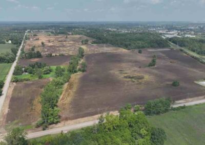
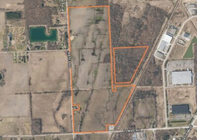
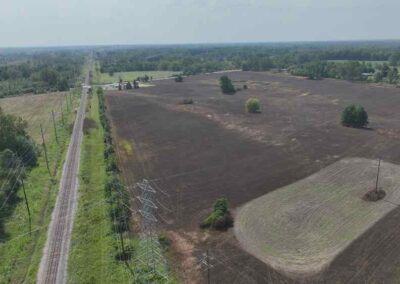
56220 Bates Road is a vacant industrial site consisting of 3 parcels totaling 153 acres in Chesterfield Township, Michigan. The property is well connected to infrastructure, benefiting from proximity to Interstate 94, M-19 and the railroad along the east side of the site.
In 2025, the site underwent the On-Site Investigation stage of the VIP program, undergoing additional site diligence and enhancement of the previously completed report (full report in the document library below).
Zoning and Land Use
Zoning: M-1 Light Manufacturing
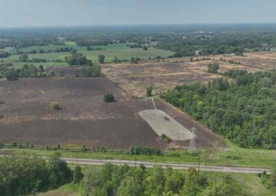
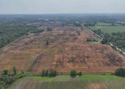
Current Land Use: Vacant Land, Agricultural
Future Land Use: M1 – Light Industrial
Site Conditions
Greenfield or Brownfield: Greenfield
Above ground structures: Farmhouse and outbuildings on parcel -001
Floodplain: This site is not located in the 100 or 500 year floodplain.
Wetlands: Wetlands exist on part of parcel -009
Topographic Elevation: Elevation of the site ranges between approximately 627 and 644 feet above sea level
Soil Types:
- Pipestone sand, loamy substratum, 0 to 6 % slopes (AuB)
- Boyer loamy sand, 0 to 2 % slopes (BrA)
- Boyer loamy sand, 2 to 6 % slopes (BrB)
- Boyer sandy loam, 0 to 2 % slopes (BsA)
- Boyer sandy loam, 2 to 6 % slopes (BsB)
- Corunna sandy loam (Cw)
- Del Rey loam, 0 to 2 % slopes (DlA)
- Dryden sandy loam, 0 to 2 % slopes (DrA)
- Dryden sandy loam, 2 to 6 % slopes (DrB)
- Ensley-Parkhill complex (Ep)
- Fulton loam, 0 to 2 % slopes (FuA)
- Gilford sandy loam (Gd)
- Lenawee silty clay loam, 0 to 2 % slopes (Lg)
- Lock sandy loam, 0 to 2 % slopes (LoA)
- Minoa fine sandy loam, 0 to 4 % slopes (MsB)
- Spinks loamy sand ,0 to 2 % slopes (SpA)
- Toledo silty clay loam (Ts)
- Wasepi sandy loam, 0 to 2 % slopes (WtA)
- Wasepi-Pipestone complex, 0 to 4 % slopes (WvB)
Easements:
- 100-foot-wide Consumers easement along east property line of parcel -002 (not onsite)
- Varying width Consumers easement splits parcel -009 (not onsite)
Utilities

Electric
Provider: DTE Energy
Capacity to Serve Demand: A new 120 kV industrial substation is needed to serve customer load up to 15 MW
Assumed Demand: 15 MW
Nearby Infrastructure Detail:
- 13.2 kV aerial system along west property line (Bates Road)
- 120 kV aerial system between parcels -002 and -009

Natural Gas
Provider: SEMCO Energy
Capacity to Serve Demand: The assumed demand baseline for the Site can be met
Assumed Demand: 17 MCFH (mcf/hour)
Nearby Infrastructure Detail:
- 2” plastic – 55 pound system on west side of Bates Road at northwest corner of site
- 8” and 12” steel – 450 pound system on east property line along railroad

Water
Provider: Great Lake Water Authority (GLWA)
Capacity to Serve Demand: The assumed demand baseline for the Site can be met
Assumed Demand: 150,000 GPD
Nearby Infrastructure Detail:
- 16” main along south side of 25 Mile Road
- 12” stub on east side of Bates Road

Sewer
Provider: Great Lakes Waters Authority
Capacity to Serve Demand: There is no sewer available to connect to within 1 mile of the site.
Assumed Demand: 100,000 GPD
Nearby Infrastructure Detail: Sewer is over 1 mile away from site.
Workforce Data
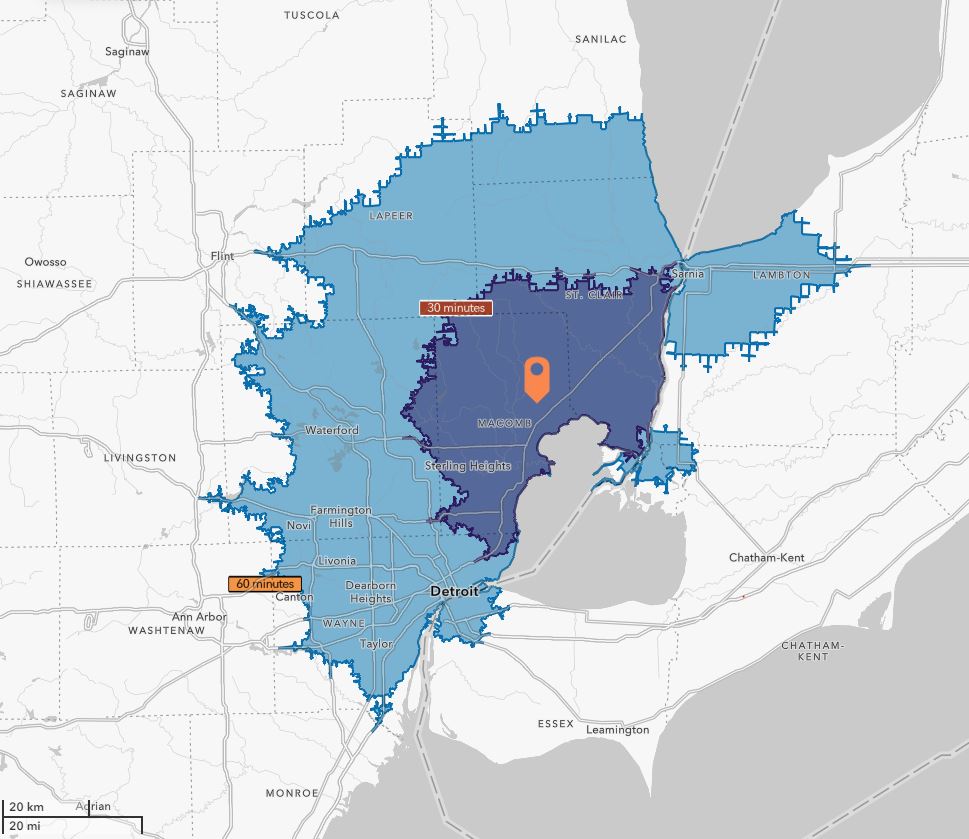
30-Minute Drive
1,018,199
Population
29,329
Total Businesses
355,546
Active Workforce
60-Minute Drive
3,891,213
Population
129,134
Total Businesses
1,766,546
Active Workforce
Transportation
Proximity to Highways
Site access on 25 Mile Road and Bates Road
0.5 miles to Gratiot Avenue
2.0 miles to I-94 access
Proximity to Rail
Less than 0.1 miles to Class 1 Canadian National Railroad
20 miles to CN Cargo Flo located at 12010 Toepfer Road (Warren, MI)
Proximity to Airports
49 miles to Detroit Metro Airport (Romulus, MI)
5 miles to Ray Community Airport (Ray, MI)
Document Library
On-Site Investigation Report with Site Maps
Marketing Flyer
Demographic & Business Data
Workforce Profile
Regional Overview
Completed Physical Site Studies
Test Fit – Completed 2/13/2025
Rail Study – Completed 2/13/2025
Phase 1 ESA – Completed 11/8/2025
Water Main Flow Test – Completed 2/13/2025
Traffic Impact Study – Completed 2/13/2025
Cultural Resource Assessment – Completed 1/13/2025
Threatened & Endangered Species Assessment – Completed 2/7/2025
Geotechnical Report – Completed 12/31/2024
Site Contacts
Site Representative
Christopher Monsour
Vice President
Signature Assocciates
Phone: (248) 948-0107
County Contact
Jack Johns
Program Director
Macomb County Planning and Economic Development Department
Email: jack.johns@macombgov.org
Phone: (586) 256-7487
Program Contact

Shannon Selby
Vice President of Real Estate
