Groveland Township Industrial Land
7083 Grange Hall Road
Groveland Township, MI 48442
Site information updated 7/24/2025
CITY
Groveland Township
COUNTY
Oakland
ACRES
189 acres
PRICE
Negotiable
ZONING
Flexible Corridor
DOWNLOAD
Marketing Flyer
Property Description
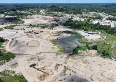
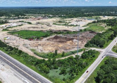
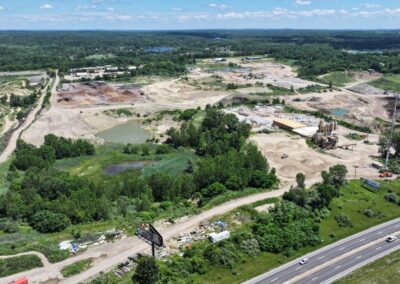
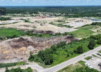
7083 Grange Hall Road is a 189-acre industrial site near the village of Holly in Groveland Township, MI. The property is well connected to infrastructure, benefiting from proximity to Interstate I-75 and Dixie Highway. The property is well positioned on the I-75 corridor between the cities of Detroit and Flint, with convenient highway access to Lansing, Ann Arbor, Port Huron, and beyond.
In 2025, the site underwent a comprehensive due diligence review through the VIP program, including a detailed site condition analysis, comprehensive information on utility providers and capacity, and a comprehensive report on site details (full report in the document library below).
Zoning and Land Use
Zoning: Flexible Corridor (FC)
- IT (Flexible Corridor – Innovation/Tech) District
- GHC (Flexible Corridor – Grange Hall Commercial) District within the Dixie Highway Corridor (DHC) Overlay
Current Land Use:
- Large aggregate (sand, gravel, etc.) mining operations
- Michigan Task Force One Mutual Aid Box Alarm System and Urban Search and Rescue Facility
- Fire and State Police Station Building
- Several communication towers
- Single Family Home
- Concrete production facility adjacent to site
Future Land Use: Development
Site Conditions
Greenfield or Brownfield: Brownfield
Above ground structures: Structures on the site include a single-family home on Grange Hall Road, two public safety facilities at the southeast corner of the property along Grange Hall Road, two communication towers adjacent to the interstate, billboards along the interstate, and multiple small work/office buildings and trailers throughout the site. Refer to the “Site Improvements” of Section 2 for additional detail.
Floodplain: No FEMA floodplain mapped on site
Wetlands: Potential wetlands on site
Topographic Elevation: Elevation of the site ranges between approximately 970 and 1050 feet above sea level
Soil Types:
- Pits (±25%, ±48 acres)
- Udipsamments, rolling to steep (±21%, ±41 acres)
- Marlette sandy loam, 1 to 6 percent slopes (±21%, ±40 acres)
- Marlette sandy loam, 6 to 12 percent slopes (±12.5%, ±24 acres)
- Udipsamments, undulating (±5.6%, ±11 acres)
- Houghton and Adrian mucks (±4%, ±8 acres)
- Marlette loam, 18 to 35 percent slopes (±3.5%, ±7 acres)
- Oshtemo-Boyer loamy sands, 0 to 6 percent slopes (±3.4%, ±6.5 acres)
- Udorthents, loamy, nearly level (±1.8%, ±3.5 acres)
- Spinks loamy sand, 6 to 12 percent slopes (1.0%, 2 acres)
- Oshtemo-Boyer loamy sands, 6 to 12 percent slopes (<1%, ±1 acres)
- Aquents, sandy, loamy, undulating (<1%, ±1 acres)
Easements: Many easements, including ingress & egress, access, telecommunications, AT&T/Michigan Bell Telephone, and Consumers Energy were reported by the preliminary title investigation. Refer to the “Title Overview” slide for additional details.
Utilities

Electric
Provider: Consumers Energy
Capacity to Serve Demand:
- Short Term Capacity: 1.1 MW
- Long Term Capacity: T.B.D. Infrastructure upgrades required for larger demand
Assumed Demand: 15 MW
Nearby Infrastructure Detail:
- 4.8/8.32 kV three-phase lines located along Grange Hall Road
- 138 kV lines located 6 miles west of the site

Natural Gas
Provider: Consumers Energy
Capacity to Serve Demand: 26 MCFH (thousand cubic feet per hour) baseline demand assumed can be met with the infrastructure improvements (gas line size upgrade) required by Consumers Energy
Assumed Demand: 26 MCFH
Nearby Infrastructure Detail:
- 4-inch steel high pressure (190 psig) gas main along Grange Hall Road and Dixie Highway
- 2-inch plastic medium pressure distribution line along the north side of Shields Road
- 4-6 inch plastic service line on the site, running from Grange Hall Road north to the concrete plant located at 14311 CMI Drive

Water
Provider: Private wells on site required
Capacity to Serve Demand: To be determined by on site well system design for users and a proposed site plan.
Assumed Demand: 300,000 GPD
Nearby Infrastructure Detail: No public water main service. Private wells on site required

Sewer
Provider: Private septic on site required
Capacity to Serve Demand: To be determined by on site septic system design for users and a proposed site plan.
Assumed Demand: 200,000 GPD
Nearby Infrastructure Detail: No public sewer service. Private septic on site required at this time. Long-term township plans may provide a line extension for service in the future
Workforce Data
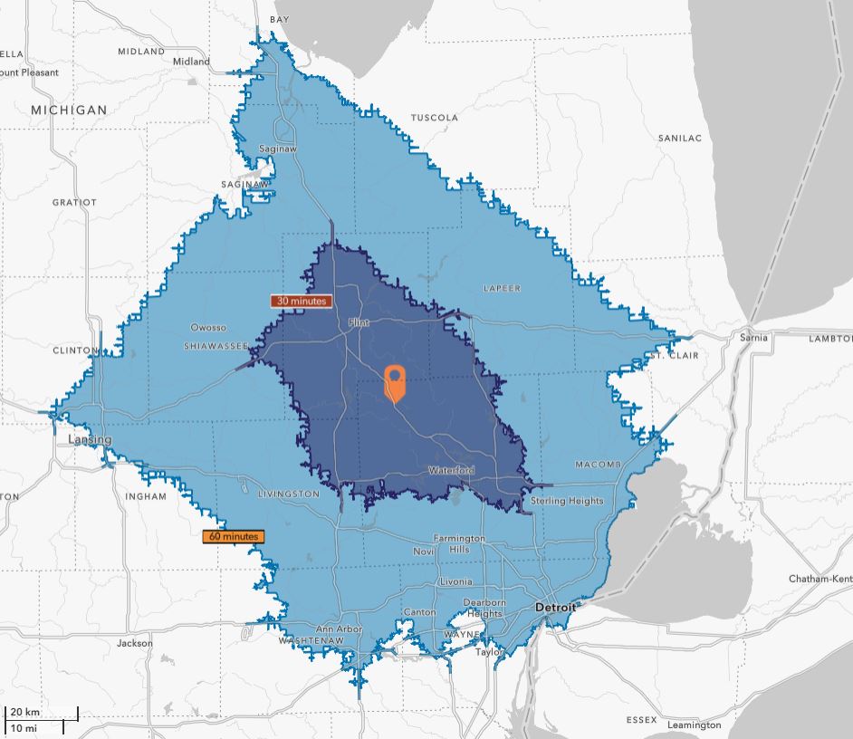
30-Minute Drive
849,780
Population
28,421
Total Businesses
368,797
Active Workforce
60-Minute Drive
4,924,031
Population
170,117
Total Businesses
2,283,293
Active Workforce
Transportation
Proximity to Highways
Site access on Grange Hall Road and Dixie Highway via Shields Road
Less than 0.5 miles to I-75 access via Grange Hall Road
Proximity to Rail
3 miles to Class 1 Canadian National Railroad
15 miles to C.N. Flint Terminal located at 3460 Bristol Road, Flint, MI 48507
35 miles to C.N. Moterm Intermodal Terminal located at 600 Fern St., Ferndale, MI
Proximity to Airports
14 miles to Bishop International Airport (Flint, MI)
13 miles to Oakland County International Airport (Waterford Township, MI)
Document Library
Site Assessment Report with Site Maps
Marketing Flyer
Demographic & Business Data
Workforce Profile
Regional Overview
Site Contacts
Site Representative
Justin Dunaskiss
Vice President
Dunaskiss Consulting & Development
Email: justin@dunaskiss.biz
Phone: (248) 877-3012
County Contact
Michael Abdallah
Business Development
Advantage Oakland
Email: Abdallahm@oakgov.com
Phone: (248) 459-1699
Program Contact

Shannon Selby
Vice President of Real Estate

